Archive for June, 2011
 Rain and thunderstorms everywhere. I guess we picked one of the worst weeks to check out the xAlps route from the air. I took advantage of the weather and connected with Lloyd Pennicuik’s (2009 Team Australia) friend Maria who stored all his maps at her place. Lloyd is lending us his hiking maps from the last race. Now I had some time checking out the maps and got confirmed what I could find out with Google Earth. Anyhow, the good old paper sure feels beats Google Earth on the trail, thanks Lloyed.
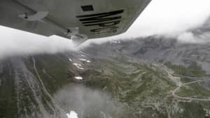 At Geneva the weather got better and we were able to fly into the mountains at Albertville. From there we explored the xAlps route along Saint-Jean-de-Maurienne to Saint-Michel-de-Maurienne and headed up the pass via Valloire. The top of the pass was clouded in and and we had to head back to Albertville and fly to the west and following the big range of mountains passing by Grenoble. This roue was very interesting and now flying there makes a lot of sense why Alex Hofer flew this route in 2007. If you have a NW flow and cloud-base below 2600m this is the way to go as you have a long ridge to fly along instead of crossing big valleys and climbing big clouded in passes.
  We flew right down to Barcelonnette and headed up the Colde la Bonette pass. From there we decided to fly back and land down in Barcelonnette
to get some fuel. The airport guy was super nice and told us to fly to Gap as the fuel is way cheaper there. So we did, fueled up and flew back to Colde la Bonette pass and followed the valley down to Isolo. We did the mistake and turned into the Isolo valley as we thought that would be the way to go. Pretty soon we found out we were one valley to early. Good thing to find this all out in a motorized aircraft instead a paraglider. Even from there down to Monaco was not as obvious as you would think. I am glad we flew an extra loop around Sospel and Monaco as this all does not look as clear you would think. 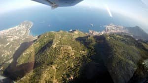 From Monaco we explored the route back to Barcelonnette and stayed there over night. The next day was blue sky and we started flying around 8:30 am and headed north from Barcelonnette to Col de Vars and then to Guillestre. From there we checked out the valley up to Briancon and then up Col du Galibier. The pass at Col Du Galibier is where we had to turn around the day before. From there we explored the Col de la Madaleine pass. From there we checked out the area going to Mt. Blanc. Mt. Blanc had a wild wave cloud on top.
 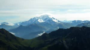 Anyways, the weather was still go to check out the whole route around the Mont Blanc right to the Matterhorn. From the Matterhorn on it started to cloud in and we able to get to Furkapass and Neufenen Pass and the south was all covered in low cloud. I was happy to get in as much as we did and we headed back to Germany which was overcast but dry.Thinking back what we have done June 3/4th and considering the weather conditions, flying the CT was absolutely outstanding. The CT from www.flightDesign.com is an amazing airplane and really puts Ultralight flying into a different dimension. The speed, fuel economy, space (for 2 people) and handling is outstanding.
  Thanks again Matthias and Henry to lend us your great plane for this job. We do appreciate this sponsorship a lot and will be proud to have your logo on my paraglider. Also, I could not have done this without Andreas, as I like to mention, having the best tools does not really mean you are the best crafts man, thanks again to Andreas Boehl (www.flyingBoehl.de) who is not just an excellent pilot but also an amazing guy understanding the weather in the Alps.
 I left Canada on June 1st and since then I am all over the place.
The hardest part leaving Canada was the last 2 weeks in Canada as I missed the kids already then (and of course Penny as well). Now since I am here things are moving along pretty fast.
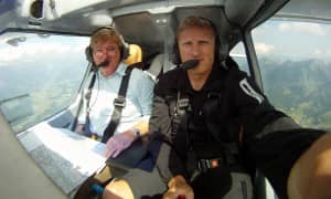
On June 3rd, I arranged my phone and Internet connection plans and headed to Krumbach to meet Andreas Boehl. Andreas is a former Phantom fighter jet pilot and logs 3000 hours in glider flying. Andreas offered to help me out in exploring the route with the CT from www.flightDesign.com.
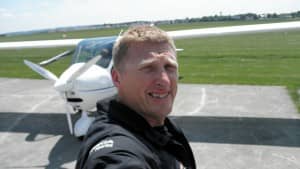 For everyone who wants to get into powered flying in Germany and or is considering to buy the “best” ultralight on the market, check out his website at www.flyingBoehl.de.
The first day was very busy as we had to get the plane from Bagnang (airport near Stuttgart). We manged to get airborne from Bad Wörishofen at 6:00 pm and headed south into the Alps. We flew by the Schloss Neuschwanstein down to Innbruck and tried to get to Brixen over the Brenner Pass.
We had to turn around at the Brenner Pass due heavy rain showers, so we headed East and found a clearing where we could cross the main ridge of the Alps to check out the area around Brixen and up to Meran. In Meran the weather was terrible again and we had to turn around to the East. This way we could checked out the route backwards from Meran to Brixen, then south of Kronnen Platz to the Drei Zinnen (xAlps turn point) and then over Sillian to Lienz. Due the weather we decided to keep on flying east to Mauterndorf as we hoped to have a better chance to fly north across the main ridge of the Alps the next day. We landed at 9:00 pm just before dark and found a nice hotel for the night. Once we arrived at the hotel, it started to rain and kept raining hard the whole night. The next morning it was still a bit of rain, ground fog and dense overcast, not looking promising to get north over the main crest of the Alps. A local pilot told us about a pass where is always a approx. 50 m clearance to get to the north side or the Alps. We decided to give it a try and sure enough after circling up a valley between clouds we found the passage to bring us to the north side of the Alps.
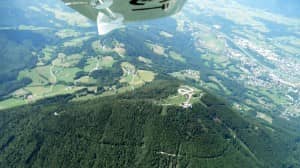
The weather was good on the north side and we headed to the west and flew up to the Grossglockner. We where able to fly right up the Grossglockner pass but then the clouds stopped us to check out the higher elevations. From there we turned around and flew to the Dachstein Glacier (2nd turn point) and then to Salzburg and checked out the Gaisberg (first turn point of the xAlps). To get a better idea of the route, we flew from there again to the Dachstein and to the Grossglockner. It was well worth doing it and I got a much better idea about the route then just checking it out via Google Earth. From the Grossglockner we headed over Kufstein direct to Bad Wörishofen (Germany). The flight for this day was 3.5 hours.
The amazing part is, that we only burned about 72 liters of fuel for 6.5 hours (both days) of flying and flew an average of about 170 km/h (top 200km/h). Again, flying the CT is not the same you would think about flying an Ultralight, this plane outperforms a small Cessna, way more fuel efficient and you can fly through some pretty wild weather.
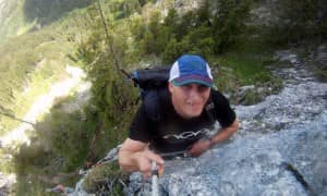
The next couple days I spend in Germany and I started to get back into my training routine. The first day I did a 4 hour climb up the “Gelbe Wand” via the new Klettersteig up to the Tegelberg. Wow, that was way more challenging then I expected. The climb itself took me just over an hour.
The day after I hiked from Immenstadt to Mittag, Steineberg and Stuiben (about 20 km) and ended up in a huge thunderstorm. The lightening show was fantastic and I was glad that we where not flying at all.
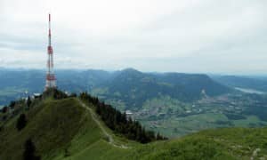
Today I hiked up Gruenten and had a fantastic view of the Allgaeur Alps right down to the Bodensee.
Tomorrows weather forecast looks promising as the thunderstorms are moving east and we have a chance to fly to Switzerland and then to France. Lets hope the weather will cooperate.
Max
